The 3D BIM model is the main deliverable in Scan to BIM projects. It is built using the point cloud captured from laser scanning. The goal is to create a model that matches the actual site with high accuracy. This model is not only visual but also includes technical data that supports design, renovation, and facility management.
Creating the model requires the right tools, correct setup, and detailed modeling. Each step must follow project standards and scope. As part of Scan to BIM services, the process involves converting point cloud data into accurate 3D geometry. Below is a breakdown of how the model is created using point cloud data inside software like Revit.
Process of Creating a 3D BIM Model from Point Cloud
1. Importing the Point Cloud
The process begins with importing the registered point cloud into BIM software. Most commonly, Autodesk Revit is used. The point cloud is usually in .rcp, .rcs, .e57, .las, or .pts format.
The point cloud is linked into Revit using the Insert Point Cloud tool. It is aligned to project coordinates, levels, and orientation. Correct placement is essential for accurate modeling.
The modeler may use section boxes, crop views, and view templates to isolate areas while working. This improves visibility and performance during modeling.
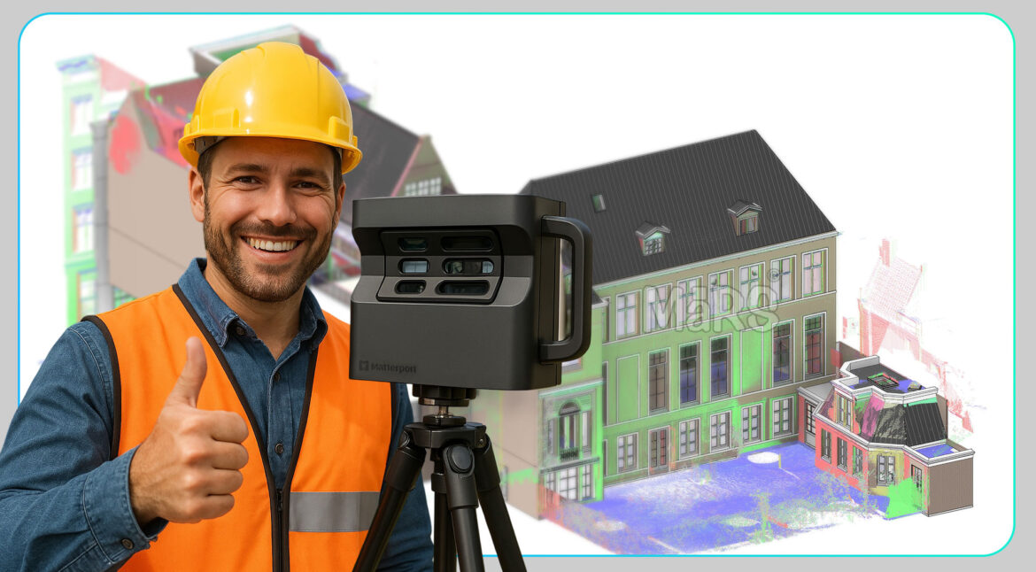
Learn How to manage and transfer massive point-cloud datasets efficiently.
2. Setting Up the Project Environment
A clean and organized Revit environment is required. The modeler sets:
- Project units (metric or imperial)
- Levels based on floor heights from the scan
- Grids for structural alignment
- View templates for plan, elevation, and 3D views
- Worksets or links if the project requires multiple models
These steps create a structured foundation for the modeling workflow.
3. Tracing the Structure from Point Cloud
The modeling begins with the core structure. This includes:
- Walls – modeled using the Wall tool. The thickness and height are matched to the scan.
- Floors – drawn as floor slabs using sketch boundaries traced from the point cloud.
- Columns – placed using structural or architectural column families.
- Roofs – modeled with slope and shape based on the scanned surface.
- Beams – traced using beam tools or in-place components.
The modeler constantly compares the Revit geometry with the point cloud. Tools like Measure Between Two References and Snaps to Point Cloud are used for precise alignment.
4. Adding Architectural and Structural Details
After the base structure is modeled, smaller elements are added:
- Doors and Windows – placed at exact scan locations using families. Dimensions like sill height and width are matched.
- Stairs and Railings – created based on the rise, run, and position captured in the scan.
- Openings – added using voids or opening families where visible in walls, floors, or ceilings.
Custom families are built if standard ones do not match the real-world objects. For older buildings or renovations, shapes may be non-standard and require detailed modeling.
5. Modeling MEP Elements (If Required)
If the scope includes MEP BIM Services, the modeler identifies and traces:
- Ducts – created using the Duct tool and sized to match scan dimensions.
- Pipes – traced with correct diameter, slope, and connection points.
- Fixtures and Equipment – placed using manufacturer-specific or custom families.
The MEP model must be coordinated with architecture and structure. Spacing, alignment, and clashes are checked throughout the process.
6. Assigning Information to Model Elements
Each component is assigned metadata. This may include:
- Material
- Dimensions
- Fire rating
- Load capacity
- Part numbers or asset IDs
Parameters are filled using Revit schedules or shared parameter files. This data supports quantity take-off, asset tracking, and maintenance planning.
7. Modeling Accuracy and LOD
The model must follow a defined Level of Detail (LOD) or Level of Development. Common LOD standards include:
- LOD 200 – basic shapes and layout
- LOD 300 – accurate geometry and location
- LOD 400 – fabrication-ready details
- LOD 500 – as-built model with real data
The LOD depends on the project use, such as renovation, coordination, or facility management.
8. Quality Check and Validation
Quality assurance is a key step. Modelers perform checks such as:
- Overlaying the model with the point cloud in 3D views
- Checking all levels, grids, and wall alignments
- Verifying door/window counts and dimensions
- Running clash detection using Navisworks or Revit Interference Check
The model must match the physical site within a tight tolerance. Usually, this is ±10 mm for LOD 300. The QA process ensures the model is usable and accurate.
9. Final Outputs and File Formats
Once approved, the model is exported in various formats:
- RVT – Revit file for direct use
- DWG – 2D drawings such as plans and sections
- IFC – open format for BIM coordination
- NWC – for Navisworks coordination
- PDFs – for simple viewing or documentation
After the model is built and passes all QA checks, it is packaged and delivered in the required file formats. These may include RVT, DWG, IFC, and PDF. The final BIM model becomes a digital version of the building or space, ready for use in design planning, coordination, construction, or operation.
A well-built Scan to BIM model reduces rework, improves project timelines, and supports better decision-making across teams.
About MaRS BIM Solutions
MaRS BIM Solutions is a trusted provider of Scan to BIM services in the USA. We specialize in converting laser scan data into precise, data-rich 3D BIM models. Our team works with architects, engineers, general contractors, and facility managers to support renovation, retrofitting, construction, and asset management projects.
We handle projects of all sizes, from small commercial renovations to large-scale industrial and infrastructure modeling. Our team has experience with complex environments such as airports, hospitals, schools, power plants, historic buildings, and manufacturing sites.
We use industry-leading tools like Autodesk Revit, ReCap, Navisworks, etc. Our models meet LOD standards (LOD 100 to LOD 500), and we follow client-specific BIM Execution Plans (BEPs). Whether you need architectural, structural, or MEP modeling, we ensure accuracy and consistency throughout the process.
We also provide model audits, clash detection, quantity take-offs, and 2D documentation from point clouds. Our team works closely with surveyors and scanning providers to register and clean point clouds before modeling.
At MaRS, we focus on accuracy, technical quality, and fast turnaround times. Our Scan to BIM deliverables support project planning, design coordination, and long-term facility management. We understand the challenges of working with as-built environments and deliver models that reflect exact site conditions with millimeter-level precision.
Looking for a reliable Scan to BIM partner? Let MaRS BIM Solutions support your next project with accurate models and dependable service. Contact us today for a free consultation.